"Col du Feu - Col des Moises" Hike
- Level green –very easy
Distance (km)
:
10
Elevation (m)
:
80
Daily duration (minutes)
:
180
Hiking itinerary

 Departure/Arrival
 Point of interest
Circuit n° 1
LIBELLE_SOUSCARTE
- SITRA services :
- Distance (km) 10
- Elevation (m) 80
- Daily duration (minutes) 180
- References topoguides :
- Cartoguide des itinéraires pédestres en vente à l'Office de Tourisme des Alpes du Léman (Bellevaux,Habère-Poche) 8 €.
- Environment :
- Mountain location
From one "Col" to the next...this is a great family hike: you can go back down the same road whenever you want.
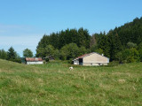
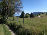
Route details: Set off from Col du Feu car park along the woodland path (ski touring and snowshoeing routes in winter) behind the wooden shelter (recycling bins) and continue for 25 minutes. You will then reach a pasture dotted with plots of spruce trees. Soon after you will reach Trécout. At the crossroads where there's a fountain, turn right to "Châtillonet - Col des Moises". Continue to Col des Moises. Go back along the same path to reach your starting point.
Opening day(s)
All year long 2026
Every day
General
- Services :
- Pets welcome
- Visites :
- Average individual visit length (minutes) 180
- SITRA services :
- Services
Equipment & Services
- Parking :
- Car park
Download


We also suggest...


Contact
Col du Feu
74470
Lullin
Phone : +33 4 50 73 71 53
Accessibility
Theme:
Share :