La boucle des Arces" hiking trail
- Level red – hard
Distance (km)
:
10.3
Elevation (m)
:
400
Daily duration (minutes)
:
240
Hiking itinerary

 Departure/Arrival
 Point of interest
Circuit n° 1
Parking on the village square or next to the church
LIBELLE_SOUSCARTE
- SITRA services :
- Distance (km) 10.3
- Elevation (m) 400
- Daily duration (minutes) 240
- References topoguides :
- Cartoguide des itinéraires pédestres en vente à l'Office de Tourisme des Alpes du Léman (Bellevaux,Habère-Poche) 8 €.
- Wandelkaart te koop bij het toeristenbureau van Alpes du Léman (Bellevaux, Habère-Poche) 8 €.
- Environment :
- In the country
- Village centre
- Forest location
- Town location
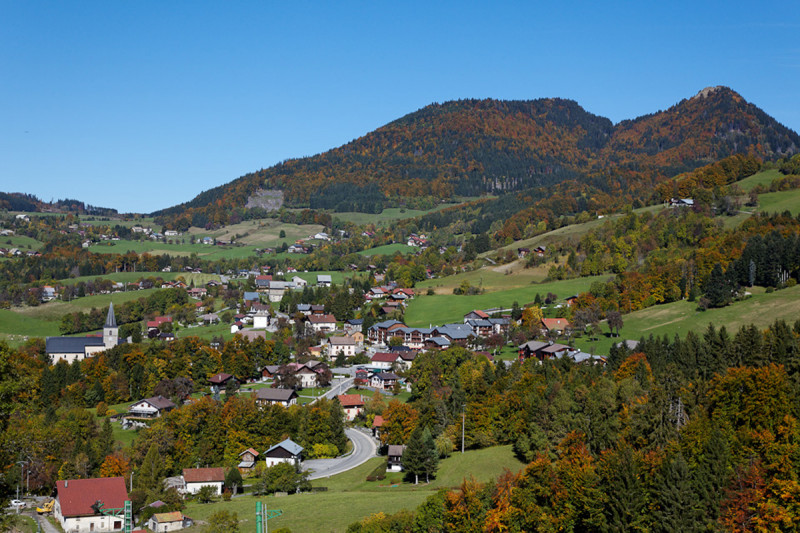
Hiking on the adret (sunniest) side of Habère-Poche, discovering hamlets and the superb Turche wood.
Along the way, you'll come across reservoirs and the Habère-Poche water catchment area. This water comes from Mont Forchat just above, the water tower of the Chablais region, supplying nearly 30,000 inhabitants with drinking water.
Opening day(s)
All year long 2026
Every day
General
- Services :
- Pets welcome
- Visites :
- Average individual visit length (minutes) 240
- SITRA services :
- Services
Equipment & Services
- Restaurants :
- Restaurant
We also suggest...
Contact
Place des Habères
74420
Habère-Poche
Phone : +33 4 50 73 78 62
Phone : +33 4 50 39 54 46
Accessibility
Theme:
Share :


