Les Meulières de la Corbière route
- Level green –very easy
Distance (km)
:
0.6
Elevation (m)
:
67
Daily duration (minutes)
:
60
Hiking itinerary

 Departure/Arrival
 Point of interest
Circuit n° 1
From Boëge, head from "Pont de Fillinges". When you reach "Corbière", follow the route de la Molière. Follow signage once you reach the main road.
LIBELLE_SOUSCARTE
- SITRA services :
- Distance (km) 0.6
- Elevation (m) 67
- Daily duration (minutes) 60
- References topoguides :
- Un cartoguide présentant des itinéraires de randonnées pédestres est en vente à l'Office de Tourisme des Alpes du Léman dans les bureaux d'accueil et d'information de Bellevaux et Habère-Poche au prix de 8 €.
- Environment :
- Mountain location
Hiking trail to learn about a little known age-old activity: stoneworkers at our region's flour mills. "Molière" is a natural setting of stunning beauty.
Duration: 1 hour
Difference in altitude: +100m
Altitude at start point: 825m
Altitude at end point: 925m
Map reference: IGN TOP 25 - 3429ET map
Signage: wood panels and yellow painting
Difficulty: easy
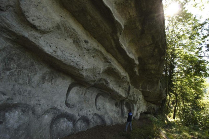
Quarries were dug out all over the forest (mainly sandstone) over 200m. Quarries have been used since Antiquity but have not been used since the mid-19th century. You can still see incomplete relics in the caves formed by the extraction of huge stones.
Opening day(s)
From 01 April to 31 October(every year)
Every day
General
- Services :
- Pets welcome
- Visites :
- Average individual visit length (minutes) 60
- SITRA services :
- Services
Download
We also suggest...
Contact
Chef lieu
74420
Saint-André-de-Boëge
Phone : +33 4 50 39 54 46
Phone : +33 4 50 73 71 53
Accessibility
Theme:
Share :


